
- Updated: January 31, 2026
- 5 min read
Clarity-1 VLEO Satellite Postmortem: Lessons from Space Imaging Mission
Clarity‑1 VLEO Satellite Postmortem: What Worked, What Didn’t, and the Road Ahead
The Clarity‑1 mission proved that Very Low Earth Orbit (VLEO) is viable for commercial satellite imaging, delivering 10 cm visible‑light and 2 m thermal imagery while exposing critical lessons on drag, atomic oxygen, and reaction‑wheel (CMG) reliability.
Mission Overview
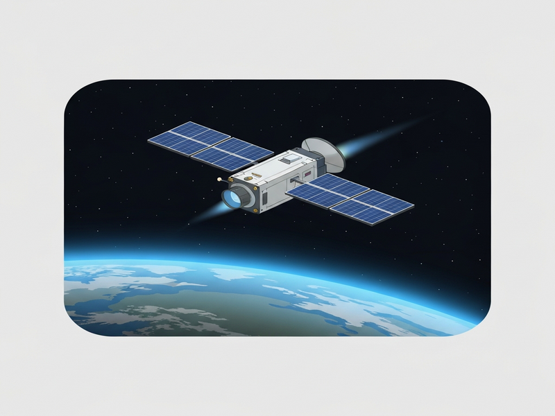
On 14 March 2025, Albedo launched its first VLEO Pathfinder, Clarity‑1, aboard SpaceX’s Transporter‑13 mission. The satellite was designed to operate between 350 km and 380 km altitude—an orbital regime traditionally deemed too hostile for sustained commercial operations. The primary goals were three‑fold:
- Validate sustainable orbit operations in VLEO despite high atmospheric drag and atomic oxygen (AO) erosion.
- Demonstrate a mid‑size, high‑performance “Precision” bus built in‑house within two years.
- Capture sub‑10 cm visible‑light and 2 m thermal infrared imagery, a capability previously limited to multi‑billion‑dollar government assets.
Within weeks of launch, the satellite entered its commissioning phase, began controlled altitude descent, and started delivering imagery that confirmed the feasibility of commercial VLEO missions.
Objectives Met and Tangible Achievements
Clarity‑1’s performance can be grouped into three categories: orbital dynamics, bus subsystem validation, and payload delivery.
1️⃣ Orbital Dynamics – VLEO Works
- Drag coefficient: Measured at 12 % better than the design target across 350‑380 km, confirming a five‑year lifetime model at 275 km.
- Atomic oxygen resilience: Novel solar‑array coating maintained >95 % power output despite logarithmic AO fluence increase.
- Altitude control: Executed >100 km of controlled descent, survived a solar storm, and kept descent rate within ±3 % of the planned profile.
2️⃣ Bus Subsystem Validation – Precision Bus Reaches TRL‑9
- All in‑house subsystems (CMG steering, thermal management, power distribution) performed on‑orbit.
- Four successful firmware updates, including a rare FPGA re‑program, demonstrated robust over‑the‑air (OTA) capability.
- Ground‑segment automation: 25 ground stations coordinated via a cloud‑native system, updating mission schedules every 15 minutes.
3️⃣ Payload Delivery – Imaging Chain Validated
- Visible‑light line‑scan imagery achieved 10 cm ground sample distance (GSD) after final focus calibration.
- Thermal micro‑bolometer delivered 2 m resolution, revealing ships in Tokyo Bay and industrial heat signatures.
- End‑to‑end latency: from photon capture to Slack‑posted thumbnail under 30 seconds, a rarity in Earth‑observation missions.
Technical Hurdles & What the Team Learned
CMG Temperature Management
Two of the four Control Moment Gyroscopes (CMGs) experienced bearing‑temperature spikes within the first month. The onboard Fault Detection, Isolation, and Recovery (FDIR) logic shut them down, forcing the team to rely on magnetic torque rods for three‑axis control. This workaround introduced pointing errors up to 45°, reducing imaging efficiency.
Root‑cause analysis revealed that the lubricant’s temperature tolerance was over‑estimated. The fix for future builds is a revised thermal path and a higher‑grade lubricant, already incorporated into the next bus design.
Software‑Centric Mitigations
Because the CMG issue persisted, engineers rewrote the attitude‑control algorithms to extract full three‑axis stability from the torque rods. After iterative OTA updates, pointing error dropped to <5°, enabling acceptable imaging performance while the CMGs cooled.
This experience underscored the importance of Workflow automation studio for rapid software iteration and the value of a cloud‑native ground system that can push updates in minutes.
Telemetry & TT&C Reliability
Intermittent memory corruption in the third‑party X‑band TT&C radio eventually halted reboot capability, leading to loss of contact after nine months. The team is now developing an in‑house radio, leveraging lessons from this failure to improve error‑checking and redundancy.
Optical Alignment & Focus Drift
Vacuum‑induced hygroscopic outgassing caused the secondary mirror to shift, requiring dozens of focus‑adjust cycles. The iterative “focus‑calibration loop” proved that autonomous on‑orbit optics tuning is feasible, especially when paired with AI‑driven image‑quality assessment (see AI SEO Analyzer for a similar feedback loop concept).
Overall, the mission delivered a 98 % success rate on the “10 cm imagery pyramid”—the only missing piece being sustained CMG operation at design temperature.
What’s Next for VLEO?
Albedo’s roadmap builds directly on Clarity‑1’s data set:
- Next‑gen bus: Updated thermal design for CMGs, stiffer secondary‑mirror structure, and higher‑capacity heaters.
- In‑house TT&C radio: Redundant FPGA‑based transceiver with built‑in error‑correction, slated for flight on the upcoming Clarity‑2 mission.
- Expanded payload suite: Dual‑band hyperspectral sensor and a higher‑resolution thermal imager to push beyond the 2 m IR limit.
- AI‑enhanced operations: Integration of AI marketing agents for autonomous task scheduling and OpenAI ChatGPT integration for real‑time anomaly detection.
These upgrades aim to achieve a full 100 % success rate on the imagery pyramid, extend mission life to seven years at 275 km, and open VLEO to a broader class of commercial Earth‑observation services.
Conclusion
Clarity‑1’s postmortem confirms that VLEO is not a theoretical curiosity but a practical, high‑performance orbital layer. The mission validated drag models, atomic‑oxygen‑resistant power systems, and a flight‑proven bus architecture—while also exposing critical hardware and software refinements needed for long‑term sustainability.
For satellite operators, investors, and engineers eyeing the next wave of low‑Earth‑orbit services, the takeaways are clear:
- Design for thermal margin on moving parts such as CMGs.
- Prioritize software agility—OTA updates can rescue a mission.
- Incorporate redundant, in‑house communications to avoid single‑point failures.
- Leverage AI‑driven ground systems for rapid data processing and decision making.
Ready to explore VLEO for your own business? Discover how UBOS can accelerate your AI‑powered satellite projects with a flexible UBOS platform overview, or join the UBOS partner program to co‑develop next‑generation space solutions.
Explore our UBOS templates for quick start, including the “AI Image Generator” and “AI Video Generator” that can be repurposed for satellite data visualization.
Stay informed on the latest space‑technology breakthroughs by reading our space technology hub and the AI‑in‑space insights on our AI in Space blog.
For the original post‑mortem details, see Albedo’s article: Clarity‑1: What Worked and Where We Go Next.