

- Updated: July 14, 2026
- 7 min read
Time-to-Collision Based Dynamic Obstacle Avoidance Using Pretrained Vision Models for Robots in Unstructured Environments
Direct Answer
This paper introduces a vision‑only dynamic obstacle avoidance pipeline that estimates time‑to‑collision (TTC) from a single RGB camera using a pretrained monocular depth model, feature‑tracking, and bundle adjustment. By eliminating the need for robot‑specific training data or simulation‑to‑real transfer, the method delivers interpretable, data‑efficient navigation for robots operating in unstructured outdoor environments.
Background: Why This Problem Is Hard
Autonomous mobile robots must continuously detect, predict, and evade moving obstacles—people, animals, vehicles, or debris—while traversing uneven terrain. Traditional solutions fall into two broad categories:
- Sensor‑heavy approaches: LiDAR or stereo rigs provide accurate depth but add cost, weight, and power consumption, which many field robots cannot afford.
- End‑to‑end learning pipelines: Deep reinforcement learning or imitation learning can fuse raw images into control commands, yet they require thousands of hours of robot‑specific data collected in simulation or real‑world trials. The resulting policies often suffer from the “sim‑to‑real gap,” where a model that performs well in a virtual world fails when exposed to the noise, lighting changes, and terrain variability of the outdoors.
Both routes struggle with data efficiency and interpretability. Engineers need a system that can be deployed quickly, explain its decisions, and adapt to new obstacle types without retraining. The lack of a lightweight, real‑world‑only solution has become a bottleneck for scaling autonomous robots in agriculture, construction, and disaster response.
What the Researchers Propose
The authors present a modular framework that stitches together three off‑the‑shelf vision components:
- UniDepth: A large pretrained monocular depth estimator that converts each RGB frame into a dense depth map, removing the need for stereo cameras or LiDAR at inference time.
- SuperPoint & SuperGlue: A feature‑detection and matching pipeline that extracts robust keypoints and establishes correspondences across long video sequences, even under rapid motion or changing illumination.
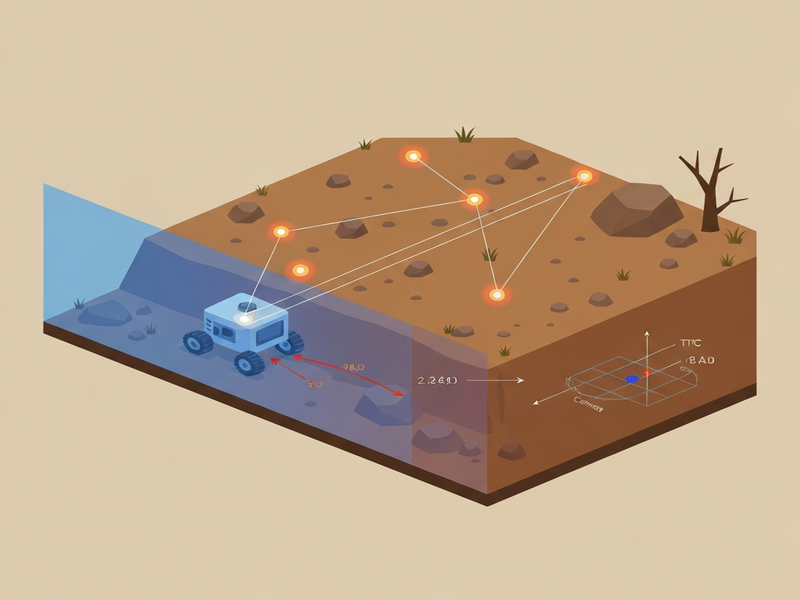
- Bundle Adjustment + TTC Computation: Using camera intrinsics and the predicted depth, the 2D keypoints are lifted into 3D space. A lightweight bundle adjustment refines their 3D positions, after which a per‑keypoint TTC is derived from the relative velocity of each point.
Once the minimum TTC keypoint is identified, the system selects a 2‑D motion primitive on the ground plane that steers the robot away from the predicted point of closest approach. The entire pipeline runs on real‑world video streams, requiring no offline simulation, no policy network, and no robot‑specific fine‑tuning.
How It Works in Practice
The operational flow can be broken down into four stages, each of which can be swapped out or upgraded independently:
1. Frame Capture & Depth Prediction
A forward‑facing RGB camera streams frames at 10–15 Hz. Each frame is fed into UniDepth, which outputs a dense depth map aligned with the original image. Because UniDepth is pretrained on massive internet datasets, it generalizes well to outdoor scenes without additional training.
2. Keypoint Detection & Long‑Term Tracking
SuperPoint extracts salient, repeatable keypoints (corners, blobs) from the current frame. SuperGlue then matches these points to those in a sliding window of previous frames (up to 30 frames back), creating long‑term tracks that survive brief occlusions.
3. 3‑D Lifting & Bundle Adjustment
Using the camera’s intrinsic matrix and the depth values at each keypoint, the 2‑D pixel coordinates are projected into 3‑D space. A lightweight bundle adjustment optimizes the 3‑D positions to minimize reprojection error across the tracked sequence, yielding a coherent set of moving points.
4. Time‑to‑Collision Estimation & Motion Selection
For each 3‑D point, the system estimates a velocity vector by fitting a linear motion model over the tracked frames. TTC is computed as the ratio of the point’s distance to the robot over the component of its velocity directed toward the robot. The point with the smallest TTC triggers a motion primitive—typically a short lateral or backward step—chosen from a predefined set of safe maneuvers on the ground plane.
What sets this approach apart is its reliance on interpretable geometric reasoning rather than opaque neural policies. Engineers can inspect the TTC map, visualize the offending keypoints, and adjust thresholds or motion primitives without retraining a model.
System Diagram
Evaluation & Results
The authors validated the pipeline on the M3ED dataset, a collection of real‑world outdoor robot runs that include a variety of moving obstacles (people, bicycles, wildlife). The evaluation focused on two questions:
- Can the system reliably flag frames where the ground‑truth TTC is below one second?
- When a low‑TTC frame is detected, does the chosen motion primitive correctly steer the robot away from the imminent collision?
Key findings include:
- Detection performance: The pipeline achieved a precision of 0.49 and a recall of 0.38 for sub‑second TTC events. While not perfect, these numbers are notable given that the method uses zero robot‑specific training data.
- Direction accuracy: In 84 % of positive detections, the selected motion primitive pointed away from the minimum‑TTC point, demonstrating that the geometric TTC estimate translates into sensible evasive actions.
- Obstacle coverage: The system identified at least one low‑TTC frame for 20 out of 22 distinct physical obstacles, indicating broad applicability across object types.
- Data efficiency: Hyper‑parameter tuning required only 74 seconds of annotated video, a stark contrast to the thousands of hours typically needed for end‑to‑end learning pipelines.
These results illustrate that a purely vision‑based, interpretable pipeline can approach the reliability of data‑hungry learning methods while remaining lightweight and adaptable.
Why This Matters for AI Systems and Agents
For robotics engineers and AI practitioners, the paper offers a blueprint for building safe navigation stacks without the heavy data collection pipelines that dominate current research. The implications are threefold:
- Rapid prototyping: Teams can integrate the pipeline into existing robot software stacks using off‑the‑shelf components, dramatically shortening development cycles.
- Interpretability and debugging: Because TTC is computed from explicit geometry, developers can visualize failure cases, adjust thresholds, or replace motion primitives without retraining a black‑box model.
- Scalable deployment: The method runs on modest compute (e.g., an edge GPU or a high‑performance CPU) and does not depend on expensive depth sensors, making it suitable for low‑cost field robots.
These advantages align with emerging trends in AI‑driven automation, where enterprises seek trustworthy, data‑efficient solutions that can be audited and regulated. For example, integrating such a pipeline into a broader UBOS platform overview could enable autonomous warehouse carts to navigate crowded aisles without costly LiDAR retrofits. Similarly, the approach can complement Workflow automation studio by providing a safety layer for robot‑assisted process flows.
What Comes Next
While the presented system marks a significant step forward, several open challenges remain:
- Robustness to extreme weather: Monocular depth models can degrade under heavy rain or fog. Future work could fuse lightweight radar or thermal cues to maintain TTC accuracy.
- Dynamic scene understanding: Extending the pipeline to classify obstacle types (e.g., human vs. animal) would enable context‑aware evasive strategies.
- Real‑time constraints: Optimizing the bundle adjustment for sub‑10 ms latency would allow higher‑speed robots to react more quickly.
- Learning‑augmented refinement: A hybrid approach that fine‑tunes the TTC thresholds using a small amount of on‑site data could improve precision without sacrificing data efficiency.
Addressing these points could unlock new applications such as autonomous agricultural sprayers that avoid livestock, or construction site robots that navigate around moving equipment. Developers interested in building such capabilities can explore the OpenAI ChatGPT integration for natural‑language command handling, or the Chroma DB integration for storing and querying scene embeddings over long deployments.
For a deeper dive into the original methodology, consult the original arXiv paper. The community is encouraged to experiment with the modular components, share benchmark results, and contribute to an open ecosystem of data‑efficient, interpretable navigation tools.
Andrii Bidochko
CTO UBOS
Andrii Bidochko is an AI entrepreneur and researcher focused on AI agents, reinforcement learning, and autonomous systems. He writes about the technologies shaping the future of machine intelligence, from frontier models and agent architectures to real-world AI applications.