UBOS Asset Marketplace: GeoServer MCP Server - Unleashing the Power of Geospatial AI
In the burgeoning landscape of AI-driven solutions, the ability to seamlessly integrate Large Language Models (LLMs) with real-world data sources is paramount. UBOS, a full-stack AI Agent Development Platform, recognizes this critical need and is proud to feature the GeoServer Model Context Protocol (MCP) server within its Asset Marketplace. This integration marks a significant step towards democratizing geospatial data interaction, enabling businesses across various sectors to harness the power of AI agents for location-based insights, automated workflows, and enhanced decision-making.
What is the GeoServer MCP Server?
The GeoServer MCP server acts as a crucial bridge, connecting LLMs to the GeoServer REST API. GeoServer, a widely used open-source server for sharing geospatial data, provides a robust platform for managing and disseminating geographic information. However, interacting with GeoServer programmatically often requires specialized knowledge and intricate API calls. This is where the MCP server shines. By implementing the Model Context Protocol (MCP), the GeoServer MCP server standardizes the way applications provide context to LLMs, making it easier for AI agents to:
- Access and Query Geospatial Data: LLMs can now directly query GeoServer’s datasets, retrieving information about features, attributes, and spatial relationships.
- Manipulate Geospatial Data: Beyond simple queries, AI agents can leverage the MCP server to create, update, and delete geospatial features, enabling automated data management workflows.
- Generate Map Visualizations: The MCP server allows AI agents to request and generate styled map images, providing a visual representation of geospatial data for analysis and reporting.
- Access OGC-Compliant Web Services: Seamlessly interact with OGC-compliant web services (WMS, WFS) offered by GeoServer.
Why is this Important? Use Cases Unveiled
The integration of GeoServer with LLMs via the MCP server unlocks a plethora of use cases across diverse industries:
- Smart Agriculture: Imagine an AI agent that can analyze soil data, weather patterns, and crop yields stored in GeoServer to provide farmers with personalized recommendations on irrigation, fertilization, and pest control. The agent could even generate maps highlighting areas at risk, enabling proactive intervention.
- Logistics and Supply Chain: Optimize delivery routes, manage warehouse locations, and track shipments in real-time by integrating geospatial data with AI-powered logistics agents. The agent could identify potential bottlenecks, predict arrival times, and dynamically adjust routes based on traffic conditions.
- Urban Planning: Assist urban planners in making data-driven decisions by analyzing demographic data, infrastructure maps, and environmental factors. An AI agent could simulate the impact of new developments, identify areas in need of revitalization, and optimize resource allocation.
- Disaster Response: Facilitate rapid and coordinated disaster response efforts by providing AI agents with access to real-time geospatial data. The agent could generate maps of affected areas, identify evacuation routes, and track the movement of emergency responders.
- Environmental Monitoring: Monitor deforestation, track pollution levels, and assess the impact of climate change by integrating satellite imagery and sensor data with AI-powered environmental monitoring agents. The agent could detect anomalies, predict future trends, and recommend mitigation strategies.
- Insurance: Assess risk by analyzing property locations relative to flood zones, earthquake fault lines, and other geographic hazards.
- Real Estate: Provide prospective buyers with detailed information about properties, including nearby amenities, school districts, and crime rates, all overlaid on interactive maps.
These are just a few examples of the transformative potential of integrating geospatial data with AI. The GeoServer MCP server empowers businesses to leverage the power of AI agents to solve complex problems, automate tasks, and gain a competitive edge.
Key Features of the GeoServer MCP Server
The GeoServer MCP server boasts a comprehensive set of features designed to facilitate seamless integration with LLMs and GeoServer:
- Workspace and Layer Management: AI agents can programmatically manage GeoServer workspaces and layers, enabling dynamic data organization and access control. This includes tools to list, create, and delete workspaces and layers, as well as retrieve detailed metadata about existing layers.
- Data Operations: Execute spatial queries on vector data using CQL (Common Query Language), enabling AI agents to retrieve specific features based on complex criteria. Agents can also update feature attributes and delete features based on predefined conditions, facilitating automated data cleaning and maintenance.
- Visualization: Generate styled map images using SLD (Styled Layer Descriptor) styles, allowing AI agents to create custom visualizations tailored to specific needs. Agents can also create and apply new styles to layers, enabling dynamic map customization.
- OGC Compliance: The MCP server provides access to OGC-compliant web services (WMS, WFS), ensuring interoperability with other geospatial platforms and applications.
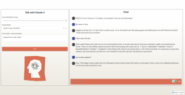
- MCP Compatibility: Designed to seamlessly integrate with MCP-compatible clients like Claude Desktop and Cursor, providing a user-friendly interface for interacting with GeoServer through LLMs.
- Multiple Installation Options: Choose between Docker, pip, and development installations to suit your specific needs and environment.
Diving Deeper: Available Tools
The GeoServer MCP server provides a range of tools for interacting with geospatial data. These tools are categorized into Workspace and Layer Management, Data Operations, and Visualization:
Workspace and Layer Management
list_workspaces: Retrieves a list of available workspaces within the GeoServer instance.create_workspace: Creates a new workspace in GeoServer.get_layer_info: Provides detailed metadata about a specific layer, including its attributes, geometry type, and spatial reference system.list_layers: Lists the layers available within a specific workspace.create_layer: Creates a new layer within a workspace.delete_resource: Removes specified resources (workspaces or layers) from GeoServer.
Data Operations
query_features: Executes CQL queries on vector data to retrieve specific features based on defined criteria.update_features: Modifies the attributes of existing features.delete_features: Removes features based on specified criteria.
Visualization
generate_map: Creates styled map images based on specified layers, styles, and spatial extent.create_style: Defines new SLD styles for customizing map visualizations.apply_style: Applies existing styles to layers.
Seamless Integration with UBOS Platform
The GeoServer MCP server seamlessly integrates with the UBOS platform, empowering users to build and deploy AI agents that leverage geospatial data within their workflows. UBOS provides a comprehensive suite of tools and services for AI agent development, including:
- Agent Orchestration: Define and manage complex AI agent workflows, connecting multiple agents to perform specific tasks.
- Data Integration: Connect AI agents to various data sources, including GeoServer, databases, and APIs.
- LLM Integration: Integrate AI agents with leading LLMs, such as OpenAI’s GPT models and Google’s PaLM models.
- Custom Agent Building: Build custom AI agents tailored to specific needs using UBOS’s low-code/no-code platform.
- Multi-Agent Systems: Develop and deploy multi-agent systems that collaborate to solve complex problems.
By leveraging the UBOS platform and the GeoServer MCP server, businesses can unlock the full potential of geospatial AI, automating tasks, improving decision-making, and gaining a competitive edge.
Getting Started
Integrating the GeoServer MCP server into your workflow is straightforward. UBOS provides comprehensive documentation and tutorials to guide you through the process. Whether you choose the Docker, pip, or development installation, you can quickly set up the server and begin experimenting with its capabilities.
The Future of Geospatial AI
The integration of LLMs with geospatial data represents a paradigm shift in how we interact with and understand the world around us. The GeoServer MCP server, featured on the UBOS Asset Marketplace, is at the forefront of this revolution, empowering businesses to harness the power of AI agents for location-based insights, automated workflows, and enhanced decision-making. As AI technology continues to evolve, we can expect to see even more innovative applications of geospatial AI emerge, transforming industries and improving lives. UBOS is committed to providing the tools and resources necessary to navigate this exciting future, empowering businesses to unlock the full potential of AI agents and geospatial data.
In conclusion, the GeoServer MCP server on the UBOS Asset Marketplace is not just a tool; it’s a gateway to a new era of geospatial intelligence. Embrace the future, empower your AI agents, and unlock the power of location with UBOS.
GeoServer MCP Server

Project Details
- mahdin75/geoserver-mcp
- MIT License
- Last Updated: 4/29/2025
Recomended MCP Servers
A Redis MCP server (pushed to https://github.com/modelcontextprotocol/servers/tree/main/src/redis) implementation for interacting with Redis databases. This server enables LLMs to...
A MCP (Model Context Protocol) server that provides get, send Gmails without local credential or token setup.
sharing what I've learned with mcp servers on mac os x.
Model Context Protocol Server for NebulaGraph 3.x
MCP to provide secure IT tools for AI network troubleshooting (remote ssh, ping, nslookup, etc)
Model Context Protocol (MCP) server for @glideapps API
Featured Templates
View More