

- Updated: July 3, 2026
- 7 min read
A Digital Twin Framework for Traffic-Aware UAV Pavement Monitoring without Lane Closure
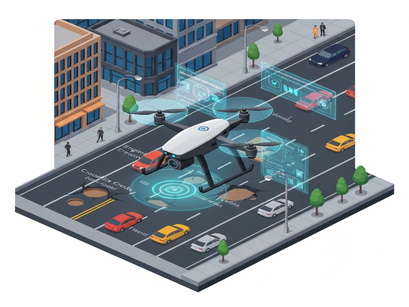
Direct Answer
The paper introduces a Unity‑based digital‑twin framework that enables traffic‑aware UAV pavement inspection without closing lanes, and it demonstrates how adaptive recovery strategies can keep inspection coverage above 97 % even in dense traffic. This matters because it bridges the gap between laboratory‑grade UAV perception research and real‑world road‑maintenance operations, where safety, cost, and uninterrupted traffic flow are critical.
Background: Why This Problem Is Hard
Road‑surface monitoring traditionally relies on ground crews or manned vehicles that must halt traffic, set up barriers, and expose workers to hazardous conditions. UAVs promise a cheaper, safer alternative, but three practical obstacles have kept large‑scale deployments out of reach:
- Dynamic occlusions: Moving vehicles, pedestrians, and temporary objects frequently block the camera’s line of sight, causing missed defects.
- Variable lighting and altitude: Changing illumination and flight height affect image resolution, which in turn impacts defect detection accuracy.
- Lack of realistic testing grounds: Existing simulators either ignore traffic dynamics or provide static environments, making it impossible to evaluate how an autonomous UAV would react to real‑time occlusions.
Current research often sidesteps these issues by assuming clear skies, empty roads, or by manually annotating occlusion‑free frames. Such simplifications limit the transferability of algorithms to the messy reality of urban streets, where any interruption can translate into costly re‑flights or missed maintenance windows.
What the Researchers Propose
The authors present a comprehensive digital‑twin ecosystem that fuses four core components:
- Procedural road‑defect generator: Randomly creates potholes, single cracks, and crocodile cracks with realistic textures and dimensions.
- Dynamic traffic and pedestrian engine: Populates the scene with vehicles and walkers that follow stochastic motion models, producing authentic occlusion patterns.
- Autonomous UAV navigation stack: Plans and executes flight paths while reacting to traffic density, altitude constraints, and on‑board perception feedback.
- Two‑stage perception pipeline: A lightweight YOLOv8n detector first localises defects, vehicles, and pedestrians; a second classifier then refines defect categories.
By integrating these modules inside Unity, the framework offers a sandbox where engineers can iterate on UAV control policies, perception models, and recovery tactics before ever stepping onto a real highway.
How It Works in Practice
The workflow can be broken down into a linear yet interactive sequence, illustrated in the diagram below.
Step‑by‑step interaction
- Environment initialization: The Unity engine spawns a road segment, injects a random mix of defects, and populates the scene with traffic agents whose speed and lane‑changing behavior follow configurable density parameters.
- Mission planning: The UAV’s flight controller selects a baseline altitude (low, medium, high) and a serpentine sweep pattern that maximizes ground coverage while respecting legal flight corridors.
- On‑board perception: As the UAV flies, each frame is fed to the YOLOv8n detector. Bounding boxes for defects, vehicles, and pedestrians are produced in real time.
- Occlusion handling: When a defect is partially or fully hidden, the system triggers one of three recovery strategies:
- Hover‑and‑recheck: The UAV pauses, hovers, and captures additional frames hoping the occluder moves.
- Micro‑repositioning: A small lateral shift is executed to obtain a new viewing angle.
- Skip‑and‑revisit: The UAV logs the missed segment and returns later after traffic clears.
- Classification: Once a defect is isolated, the second‑stage classifier assigns it to one of three categories, enabling downstream maintenance prioritization.
- Mission termination: After the sweep, the UAV logs coverage statistics, energy consumption, and any revisit ratios for post‑flight analysis.
This pipeline differs from prior work by treating occlusion as a first‑class problem and by providing a closed‑loop simulation where perception, navigation, and recovery co‑evolve.
Evaluation & Results
The authors conducted two tiers of experiments: a perception benchmark on a synthetic test set, and a full‑mission simulation across varying traffic densities and flight altitudes.
Perception benchmark
Using 5,000 annotated frames, the combined detector‑classifier pipeline achieved 99.26 % overall accuracy across five classes (pothole, single crack, crocodile crack, vehicle, pedestrian). False positives were under 0.5 % for defect categories, confirming that the lightweight YOLOv8n model can run on embedded UAV hardware without sacrificing reliability.
Mission‑level evaluation
Four operational metrics were recorded:
- Coverage: Percentage of road surface inspected at least once.
- Mission time: Total flight duration, including recovery maneuvers.
- Energy consumption: Battery usage estimated from thrust and hover time.
- Revisit ratio: Fraction of segments that required a second pass.
Key findings include:
- Higher altitudes (≈30 m) dramatically increased coverage (up to 97 %) because the camera’s field of view encompassed more lane width, reducing the chance of total occlusion.
- In medium and high traffic, the hover‑and‑recheck strategy delivered the most consistent coverage (97.03 %) while keeping extra energy under 8 % of the baseline.
- In low‑traffic scenarios, skip‑and‑revisit excelled, achieving 97.95 % coverage at medium altitude with the smallest mission‑time penalty.
- Micro‑repositioning offered a middle ground but was sensitive to UAV agility constraints; it performed best when the UAV could execute rapid lateral shifts without excessive battery drain.
Overall, the experiments prove that adaptive recovery, when informed by a realistic digital twin, can preserve high inspection quality without forcing lane closures.
Why This Matters for AI Systems and Agents
From an AI‑engineer’s perspective, the framework showcases a repeatable pattern for building “traffic‑aware” autonomous agents:
- Closed‑loop simulation: By embedding perception, control, and environment dynamics in a single engine, developers can iterate on policies with immediate feedback, reducing the costly “field‑test‑then‑tweak” cycle.
- Modular perception stack: The two‑stage YOLOv8n + classifier design demonstrates how a lightweight detector can be paired with a specialist classifier to meet strict latency budgets—an approach applicable to any edge‑deployed AI agent.
- Adaptive recovery as a policy layer: The three recovery strategies act as a decision‑making module that can be replaced with reinforcement‑learning or model‑predictive control, opening avenues for more sophisticated agents that learn optimal trade‑offs between coverage and energy.
Practically, infrastructure owners can embed such agents into existing UAV fleets, leveraging the UBOS platform overview to orchestrate missions, collect telemetry, and feed results into downstream maintenance workflows. The Workflow automation studio can then trigger alerts for high‑severity defects, schedule repair crews, and even integrate with city traffic‑management systems to minimize disruption.
What Comes Next
While the digital twin proves its worth, several limitations point to future research directions:
- Real‑world validation: Translating simulation performance to live traffic requires handling sensor noise, GPS drift, and regulatory constraints that are not fully captured in Unity.
- Multi‑UAV coordination: Scaling inspection to city‑wide networks will demand cooperative strategies, collision avoidance, and shared perception maps.
- Dynamic weather modeling: Rain, fog, and glare can degrade visual detection; integrating physics‑based weather simulators would broaden robustness.
- Learning‑based recovery: Replacing rule‑based recovery with a learned policy could adapt to novel occlusion patterns and optimize energy use in real time.
Addressing these challenges will likely involve tighter integration with cloud‑native AI services. For example, the OpenAI ChatGPT integration could provide natural‑language mission briefing and post‑flight reporting, while the Chroma DB integration offers vector‑based storage for defect embeddings, enabling similarity search across historic inspections.
Conclusion
The Unity‑based digital‑twin framework presented in the arXiv paper marks a significant step toward practical, traffic‑aware UAV pavement monitoring. By marrying procedural defect generation, realistic traffic simulation, and a two‑stage perception pipeline, the authors demonstrate that high‑coverage inspections are achievable without lane closures. Their systematic evaluation of recovery strategies provides a clear roadmap for engineers seeking to deploy autonomous inspection agents at scale.
Call to Action
Ready to explore how digital twins can accelerate your AI‑driven infrastructure projects? Visit the UBOS homepage for more details, or dive straight into the UBOS blog for additional case studies and technical guides.
Andrii Bidochko
CTO UBOS
Andrii Bidochko is an AI entrepreneur and researcher focused on AI agents, reinforcement learning, and autonomous systems. He writes about the technologies shaping the future of machine intelligence, from frontier models and agent architectures to real-world AI applications.